Select Medium
CLASS X SOCIAL SCIENCE 2 CHAPTER 2
In Search of The Source of Wind
LESSON OVERVIEW
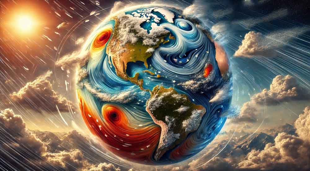
Atmosphere and winds play a crucial role in shaping Earth’s climate and weather patterns. These elements interact through complex systems, driven by differences in temperature, pressure, and the Earth’s rotation. Understanding these dynamics is essential for predicting weather and understanding the global climate.
1. Variations in Atmospheric Pressure
Atmospheric pressure is the force exerted by the weight of the air above a given point on Earth’s surface. It varies significantly based on factors such as altitude, temperature, and humidity. At sea level, the standard atmospheric pressure is approximately 1013.25 millibars (mb) or 1 atmosphere. However, as one ascends to higher altitudes, the atmospheric pressure decreases because the density of air molecules diminishes with height. This is why mountain climbers often experience difficulty breathing at high altitudes; there’s less oxygen available as the pressure drops. Temperature also influences atmospheric pressure. Warm air, being less dense, exerts lower pressure, while cold air is denser and exerts higher pressure. Humidity, or the amount of water vapor in the air, further complicates this dynamic. Moist air is lighter than dry air, so high humidity leads to lower atmospheric pressure. These variations in pressure are essential for understanding weather patterns, as they determine wind formation, storm systems, and even the everyday weather we experience. Tip to Remember: Pressure decreases with height, warm air rises, and moisture lightens the air.
2. Atmospheric Pressure and Altitude
The relationship between atmospheric pressure and altitude is inverse; as altitude increases, atmospheric pressure decreases. This is because the atmosphere becomes thinner with height, meaning fewer air molecules are exerting pressure. At sea level, the air pressure is highest because the full weight of the atmosphere is pressing down. As one moves higher, such as climbing a mountain or flying in an airplane, the number of air molecules decreases, and so does the pressure. This decrease in pressure can lead to physiological effects on the human body, such as shortness of breath and altitude sickness, as the body struggles to get enough oxygen. Understanding this concept is crucial for activities like aviation, where cabins are pressurized to maintain safe and comfortable conditions for passengers. Tip to Remember: Higher altitude equals lower pressure, thinner air, and less oxygen.
3. Temperature and Atmospheric Pressure
Temperature plays a crucial role in determining atmospheric pressure. There is an inverse relationship between temperature and pressure: as temperature increases, atmospheric pressure decreases, and vice versa. This occurs because warmer air is less dense; the molecules are more spread out, causing the air to rise and leading to lower pressure at the surface. Conversely, cooler air is denser, causing it to sink and exert higher pressure. This principle explains why tropical regions, which are generally warmer, often have lower atmospheric pressure compared to colder regions. This relationship is also why weather patterns are so closely tied to changes in temperature; for example, when warm and cold air masses meet, the difference in pressure can create fronts, leading to storms and other weather events. Tip to Remember: Warm air rises, causing low pressure; cold air sinks, causing high pressure.
4. Why Tropical Regions Experience Low Atmospheric Pressure Compared to Colder Regions
Tropical regions experience lower atmospheric pressure than colder regions due to higher temperatures and humidity levels. In the tropics, the intense heat causes the air to warm up, expand, and rise. As the warm air rises, it creates a low-pressure area at the surface. Additionally, tropical regions often have high humidity, which means there is a large amount of water vapor in the air. Water vapor is lighter than the nitrogen and oxygen that make up most of the atmosphere, so humid air is less dense and contributes to lower pressure. This combination of heat and humidity makes tropical regions prone to low-pressure systems, which are often associated with dynamic weather patterns such as thunderstorms, cyclones, and heavy rainfall. Tip to Remember: Tropics are hot and humid; hot air rises, and humid air is light, both lowering pressure.
5. Humidity and Atmospheric Pressure
Humidity, the amount of water vapor in the air, directly affects atmospheric pressure. Water vapor is lighter than the nitrogen and oxygen molecules that make up most of the atmosphere. Therefore, as humidity increases, the air becomes less dense and exerts less pressure. This relationship is particularly important in understanding weather systems. High humidity typically leads to lower pressure, which can contribute to the development of storms and cyclones. Conversely, dry air, with less water vapor, is denser and leads to higher atmospheric pressure. This dynamic is a key factor in forecasting weather and understanding the climate in various regions around the world. Tip to Remember: More humidity equals lower pressure; moist air is lighter.
6. Isobars
Isobars are lines on a weather map that connect points of equal atmospheric pressure. These lines are essential tools in meteorology because they help visualize pressure systems and predict wind patterns. Isobars can indicate areas of high and low pressure, and the spacing between them provides insights into wind speed: closely spaced isobars indicate strong winds, while widely spaced isobars suggest lighter winds. For example, when isobars form a circular pattern, they can indicate the presence of a high-pressure system (anticyclone) or a low-pressure system (cyclone). Understanding isobars is crucial for weather forecasting, as they help predict phenomena like storms, calm weather, and temperature changes. Tip to Remember: Isobars are pressure lines; closer lines mean stronger winds.
7. Isotherms
Isotherms are lines on a weather map that connect points of equal temperature. They are used in meteorology to depict temperature distributions across different regions. By analyzing isotherms, meteorologists can identify temperature gradients, which are areas where the temperature changes rapidly over a short distance. These gradients are often associated with weather fronts, such as cold fronts or warm fronts, where different air masses meet, leading to weather changes like storms or clear skies. Isotherms are also used to study climate patterns and compare temperatures across different seasons or years. Tip to Remember: Isotherms equal temperature lines; they show heat distribution.
8. Global Pressure Belts
Global pressure belts are zones of high and low pressure encircling the Earth, created by the uneven heating of the planet’s surface. These belts play a critical role in shaping the world’s climate and weather patterns. The major pressure belts include the Equatorial Low Pressure Belt, Subtropical High Pressure Belt, Subpolar Low Pressure Belt, and Polar High Pressure Belt. The Equatorial Low Pressure Belt, found near the equator, is characterized by rising warm air and frequent rainfall. The Subtropical High Pressure Belt, located around 30° latitude, is associated with descending dry air and desert climates. The Subpolar Low Pressure Belt, around 60° latitude, is where cold polar air meets warmer air from the mid-latitudes, leading to stormy weather. The Polar High Pressure Belt, near the poles, is characterized by cold, dense air and dry conditions. These belts shift with the seasons, influencing the movement of winds and the distribution of precipitation around the globe. Tip to Remember: Remember “ESPE” (Equatorial, Subtropical, Polar, Subpolar) for pressure belts from equator to poles.
9. Equatorial Low Pressure Belt
The Equatorial Low Pressure Belt, also known as the Intertropical Convergence Zone (ITCZ), is a low-pressure area located near the equator where the trade winds from both hemispheres converge. This convergence causes the air to rise, creating a zone of low pressure. The Equatorial Low Pressure Belt is significant for global weather patterns as it is associated with heavy rainfall and thunderstorms. The ITCZ shifts north and south with the seasons, affecting monsoon patterns and contributing to the climatic differences between wet and dry seasons in tropical regions. The consistent low pressure in this region leads to the formation of rainforests, characterized by high humidity and precipitation throughout the year. Tip to Remember: Equator equals low pressure; trade winds meet here causing rain and storms.
10. Subtropical High Pressure Belt
The Subtropical High Pressure Belt is located around 30° latitude in both the northern and southern hemispheres. This belt is characterized by descending air that results in high pressure at the surface. The air here is dry and stable, leading to clear skies and little precipitation, which is why many of the world’s deserts are located in these regions (e.g., Sahara, Arabian Desert). These high-pressure systems are known as anticyclones and play a significant role in the global circulation of winds, contributing to the trade winds and westerlies. The Subtropical High Pressure Belt is also responsible for the calm and dry conditions associated with the “horse latitudes.” Tip to Remember: Think 30° for deserts; high pressure, dry air, clear skies.
11. Horse Latitudes
The Horse Latitudes are regions located at approximately 30° latitude north and south of the equator, characterized by calm winds and high pressure. These areas are known for their dry and stable atmospheric conditions, often leading to deserts such as the Sahara and the Australian Outback. The term “Horse Latitudes” is thought to have originated from the age of sailing ships, when ships would become becalmed in these regions due to the lack of wind, sometimes leading to the necessity of throwing horses overboard to conserve water. The high-pressure systems in these latitudes contribute to the formation of the trade winds and the westerlies, which play a crucial role in global wind patterns. Tip to Remember: Horse Latitudes equal calm winds, high pressure, deserts.
12. Subpolar Low Pressure Belt
The Subpolar Low Pressure Belt is located around 60° latitude in both the northern and southern hemispheres. These belts are characterized by rising air, leading to low pressure at the surface. This zone is associated with frequent cyclonic activity, leading to stormy and wet weather. The interaction between the cold polar easterlies and the warmer westerlies at these latitudes creates unstable weather conditions. The Subpolar Low Pressure Belt plays a crucial role in the formation of mid-latitude cyclones, which are significant weather systems affecting the temperate regions. These cyclones are responsible for much of the precipitation in these areas and can lead to significant weather events like snowstorms and heavy rain. Tip to Remember: Subpolar equals stormy; 60° latitude, low pressure, cyclones.
13. Polar High Pressure Belt
The Polar High Pressure Belt is located near the poles (90° latitude north and south) and is characterized by descending cold air that creates high pressure at the surface. These high-pressure zones are associated with very cold temperatures and dry conditions. The air at the poles is extremely dense and heavy, leading to stable atmospheric conditions with clear skies. The Polar High Pressure Belt influences the climate of polar regions, contributing to the formation of the polar easterlies, which are cold, dry winds that blow from the poles towards lower latitudes. These belts are critical in maintaining the frigid climates of the polar regions and play a role in the global circulation of air. Tip to Remember: Poles equal high pressure; cold, dry, stable weather.
14. Names of Different Pressure Belts and Their Latitudinal Extent
The Earth’s atmosphere is divided into distinct pressure belts, each with its unique characteristics and latitudinal extent. These include:
• Equatorial Low Pressure Belt (0° latitude): Located near the equator, characterized by rising warm air and heavy rainfall.
• Subtropical High Pressure Belt (30° N and 30° S latitude): Associated with descending dry air, clear skies, and desert climates.
• Subpolar Low Pressure Belt (60° N and 60° S latitude): Characterized by rising air, cyclonic activity, and stormy weather.
• Polar High Pressure Belt (90° N and 90° S latitude): Found at the poles, associated with descending cold air, dry conditions, and clear skies. These pressure belts shift with the seasons, affecting global wind patterns and precipitation distribution. Tip to Remember: “ESPE” (Equatorial, Subtropical, Polar, Subpolar) from equator to poles.
15. Atmospheric Pressure and Winds
Atmospheric pressure is a key driver of wind patterns. Winds are created by the movement of air from high-pressure areas to low-pressure areas. The greater the difference in pressure, the stronger the wind. This movement is influenced by the Earth’s rotation (Coriolis Effect) and friction with the Earth’s surface. In the upper atmosphere, where friction is minimal, winds can reach high speeds, forming jet streams that influence weather patterns globally. Near the surface, winds are slowed by friction but are still driven by pressure gradients. Understanding this relationship is crucial for predicting weather systems, from gentle breezes to powerful storms. Tip to Remember: Winds flow from high to low pressure; greater difference equals stronger winds.
16. Pressure Gradient
The pressure gradient is the rate of change in atmospheric pressure between two points on the Earth’s surface. It is the primary force driving wind movement. A steep pressure gradient, where there is a significant difference in pressure over a short distance, results in strong winds. Conversely, a gentle pressure gradient leads to lighter winds. The direction of the wind is also determined by the pressure gradient, as air moves from high-pressure areas to low-pressure areas. This concept is visualized on weather maps using isobars, where closely spaced isobars indicate a steep gradient and strong winds, while widely spaced isobars indicate a gentle gradient and calm winds. Tip to Remember: Steep gradient equals strong wind; high to low pressure.
17. Movement of Sun and Pressure Belts
The movement of the sun throughout the year causes the pressure belts on Earth to shift north and south. This shift is due to the tilt of the Earth’s axis and its orbit around the sun, leading to changes in the amount of solar energy received at different latitudes. During the summer solstice, the sun is over the Tropic of Cancer, causing the pressure belts to move northward. Conversely, during the winter solstice, the sun is over the Tropic of Capricorn, causing the belts to shift southward. This seasonal movement of pressure belts influences global wind patterns, monsoons, and precipitation distribution. Tip to Remember: Sun’s movement equals shifting belts; north in summer, south in winter.
18. Coriolis Force
The Coriolis Force is an apparent force caused by the rotation of the Earth, which deflects the path of moving objects, including air currents. In the northern hemisphere, the Coriolis Force causes winds to deflect to the right, while in the southern hemisphere, it causes them to deflect to the left. This deflection affects global wind patterns and the formation of cyclones and anticyclones. The Coriolis Force is crucial in determining the rotation direction of large-scale weather systems, such as hurricanes and typhoons, which rotate counterclockwise in the northern hemisphere and clockwise in the southern hemisphere. Tip to Remember: Coriolis equals curve; right in the north, left in the south.
19. Friction
Friction plays a significant role in the movement of winds, especially near the Earth’s surface. As air moves over land, it encounters obstacles such as trees, buildings, and mountains, which create friction and slow down the wind. This frictional force also causes the wind to change direction slightly, reducing its speed and making it less uniform. In the upper atmosphere, where friction is minimal, winds can move faster and more freely, forming jet streams. Understanding the role of friction is essential for accurate weather forecasting and for predicting the impact of winds on various activities, including aviation and maritime operations. Tip to Remember: Friction equals slowing winds; obstacles reduce speed, change direction.
20. Pressure Belts and Winds
The global pressure belts play a crucial role in the formation and direction of winds. The differential heating of the Earth’s surface creates areas of high and low pressure, driving the movement of air. For example, the Equatorial Low Pressure Belt causes air to rise and move towards the Subtropical High Pressure Belts, creating the trade winds. Similarly, the westerlies and polar easterlies are driven by the interaction between the Subtropical High Pressure Belts and the Subpolar Low Pressure Belts. These wind patterns are essential for distributing heat and moisture around the planet, influencing climate and weather systems globally. Tip to Remember: Pressure belts drive winds; high to low pressure, global patterns.
21. Westerlies
Westerlies are winds that blow from the west to the east between 30° and 60° latitude in both hemispheres. They are part of the global wind system and are driven by the rotation of the Earth and the pressure gradient between the Subtropical High Pressure Belts and the Subpolar Low Pressure Belts. The westerlies play a crucial role in the weather patterns of temperate regions, bringing moist air from the oceans inland, which contributes to precipitation and weather systems like cyclones. They are also responsible for the eastward movement of weather systems in the mid-latitudes. Tip to Remember: Westerlies equal west-to-east; temperate latitudes, 30°-60°.
22. Polar Easterlies
Polar Easterlies are cold winds that blow from the polar high-pressure areas towards the subpolar low-pressure areas, generally from the east to the west. These winds are found between 60° latitude and the poles in both hemispheres. They are cold and dry, influencing the climate of polar and subpolar regions by bringing cold air masses. The interaction of Polar Easterlies with Westerlies can lead to the formation of polar fronts, which are significant for weather systems in higher latitudes. Tip to Remember: Polar Easterlies equal east-to-west; cold, dry, polar regions.
23. Periodic Winds
Periodic winds are winds that change their direction and intensity periodically, often influenced by seasonal changes. Examples of periodic winds include monsoons, which change direction between summer and winter, and land and sea breezes, which change between day and night. These winds are different from prevailing winds, which have a consistent direction, and from variable winds, which change direction unpredictably. Periodic winds play a significant role in climate and weather patterns, especially in regions like South Asia, where monsoons bring seasonal rainfall essential for agriculture. Tip to Remember: Periodic equals change; think monsoons, day/night breezes.
24. What is Monsoon
A monsoon is a seasonal wind pattern that causes a significant shift in weather conditions, particularly in tropical regions. Monsoons are characterized by a reversal in wind direction between summer and winter. In summer, the wind blows from the ocean towards the land, bringing heavy rainfall, while in winter, it blows from the land towards the ocean, leading to dry conditions. The impact of monsoons is profound, particularly in South Asia, where the summer monsoon brings much-needed rain for agriculture but can also cause flooding. Tip to Remember: Monsoon equals seasonal switch; wet summers, dry winters.
25. North East Monsoon Winds
The North East Monsoon Winds, also known as the winter monsoon, blow from the northeast during the winter months in the northern hemisphere. These winds are generally dry and bring cool air from the interior of the continent to the ocean. In South Asia, the North East Monsoon affects the southern states of India, such as Tamil Nadu and Kerala, bringing moderate rainfall during the winter months, which is crucial for the Rabi crops. The North East Monsoon is also associated with cooler temperatures and drier conditions compared to the summer monsoon. Tip to Remember: North East equals winter monsoon; dry, cool, winter rains in South India.
26. Land and Sea Breeze
Land and sea breezes are daily wind patterns that occur due to the differential heating of land and sea. During the day, land heats up faster than the sea, causing the air over the land to rise and create a low-pressure area. The cooler, high-pressure air from the sea then moves in to replace it, creating a sea breeze. At night, the process reverses; the land cools down faster than the sea, causing the air over the sea to rise and create a low-pressure area, while the cooler air from the land moves towards the sea, creating a land breeze. These breezes are important for coastal climates and can influence temperature and weather patterns in coastal regions. Tip to Remember: Day equals sea breeze; night equals land breeze; land heats/cools faster.
27. Mountain and Valley Breeze
Mountain and valley breezes are local wind patterns that occur in mountainous regions due to temperature differences between the mountains and the valleys. During the day, the sun heats the slopes of the mountains faster than the valley, causing the warm air to rise up the slopes, creating a valley breeze. At night, the slopes cool down faster than the valley, causing the cooler air to descend into the valley, creating a mountain breeze. These breezes affect local climate and can influence agriculture and habitation patterns in mountainous areas. Tip to Remember: Day equals valley breeze (up); night equals mountain breeze (down).
28. Local Winds
Local winds are winds that blow over a relatively small area and are influenced by local geographical features and temperature differences. Examples include the Harmattan in West Africa, which is a dry and dusty trade wind; the Loo in India, which is a hot and dry wind that blows across the plains during summer; and the Föhn in the Alps, which is a warm, dry wind that descends the leeward side of mountains. Local winds can have significant impacts on the local climate and weather, influencing agricultural practices, health, and daily life. Tip to Remember: Local winds are specific to areas; think Harmattan, Loo, Föhn.
29. Harmattan
The Harmattan is a dry and dusty trade wind that blows from the Sahara Desert across West Africa. It typically occurs during the winter months (November to March) and is characterized by dry air, low humidity, and large amounts of dust, which can significantly reduce visibility and affect air quality. The Harmattan can cause cooler temperatures in the mornings and evenings but can also bring extreme dryness, impacting agriculture and health. This wind is particularly known for its ability to carry dust particles across the Atlantic Ocean, affecting air quality as far as the Caribbean. Tip to Remember: Harmattan equals dry, dusty wind from the Sahara; winter in West Africa.
30. Loo
The Loo is a hot and dry wind that blows across the plains of northern and northwestern India during the summer months. It typically occurs in May and June, before the onset of the monsoon, and is characterized by extremely high temperatures that can exceed 45°C (113°F). The Loo can cause severe heat waves, leading to dehydration and heatstroke. It significantly affects daily life, agriculture, and water availability in the affected regions. The Loo is feared for its intensity and is often associated with the harsh, dry conditions of the Indian summer. Tip to Remember: Loo equals hot, dry wind; Indian summer, extreme heat.
31. Mango Showers
Mango Showers are pre-monsoon showers that occur in the southern states of India, particularly in Kerala and Karnataka. These showers usually occur in April and May and are called “Mango Showers” because they help in the ripening of mangoes. These rains also provide relief from the heat of the summer and help in preparing the soil for the upcoming monsoon season. They are crucial for agriculture, as they support the growth of various crops and help in maintaining soil moisture levels. Mango Showers are a welcome phenomenon in the region, often signaling the imminent arrival of the monsoon. Tip to Remember: Mango Showers equal pre-monsoon rains; ripen mangoes, cool summer heat.
32. Variable Winds
Variable winds are winds that frequently change their direction and speed. These winds do not follow a consistent pattern and can be influenced by various local factors, such as topography and weather systems. Examples of variable winds include gusts, which are short bursts of high-speed winds, and squalls, which are sudden, sharp increases in wind speed. Variable winds can pose challenges for navigation and aviation and can also impact local weather conditions, sometimes leading to rapid weather changes. These winds are unpredictable and can lead to sudden changes in temperature, precipitation, and overall weather conditions. Tip to Remember: Variable equals change; think gusts, squalls, unpredictable.
33. Cyclones
Cyclones are low-pressure systems characterized by rotating winds that move inward towards the center of low pressure. In the northern hemisphere, cyclones rotate counterclockwise, while in the southern hemisphere, they rotate clockwise. Cyclones can form over tropical or temperate regions and are associated with strong winds, heavy rainfall, and storm surges. Tropical cyclones, such as hurricanes and typhoons, form over warm ocean waters and can cause significant damage and loss of life due to their intensity and destructive power. Temperate cyclones, also known as extratropical cyclones, form in mid-latitudes and are associated with varying weather conditions, including rain, snow, and thunderstorms. Tip to Remember: Cyclones equal low pressure; inward-rotating winds, storms, rain.
34. Tropical Cyclones and Temperate Cyclones
Tropical cyclones are intense low-pressure systems that form over warm ocean waters, typically between 5° and 20° latitude. They require sea surface temperatures of at least 26.5°C (80°F) to develop. Tropical cyclones are characterized by strong winds, heavy rainfall, and potential to cause widespread destruction. In contrast, temperate cyclones, also known as extratropical cyclones, occur in the mid-latitudes between 30° and 60° latitude. They derive their energy from horizontal temperature gradients and are associated with varying weather conditions, including rain, snow, and thunderstorms. While tropical cyclones are known for their destructive power, temperate cyclones play a crucial role in the weather patterns of temperate regions. Tip to Remember: Tropical equals warm water; temperate equals temperature gradients.
35. Anticyclones
Anticyclones are high-pressure systems characterized by descending air that moves outward from the center of high pressure. In the northern hemisphere, anticyclones rotate clockwise, while in the southern hemisphere, they rotate counterclockwise. These systems are associated with clear skies, calm weather, and stable atmospheric conditions. Anticyclones can lead to prolonged periods of dry weather and are often responsible for heatwaves during the summer and cold snaps during the winter. They play a crucial role in influencing regional weather patterns and can impact agriculture, water resources, and daily life. Tip to Remember: Anticyclones equal high pressure; descending air, clear skies, stable weather.
This content provides a comprehensive overview of each topic, with descriptions, examples, additional information, and tips for easy remembrance.
Key Points to Remember
- Atmospheric Pressure: It decreases with altitude and is influenced by temperature and humidity, with warm, humid air creating lower pressure.
- Pressure Belts: The Earth has distinct pressure belts (Equatorial Low, Subtropical High, Subpolar Low, Polar High) that shift with the seasons and drive global wind patterns.
- Winds: Winds move from high to low pressure areas and are affected by the Coriolis Force, which causes them to curve due to Earth’s rotation.
- Global Wind Patterns: Trade winds, westerlies, and polar easterlies are key wind systems that influence weather across different latitudes.
- Local Winds: Local winds, such as land and sea breezes, mountain and valley breezes, and periodic winds like monsoons, are driven by local temperature differences and geographic features.
- Cyclones and Anticyclones: Cyclones are low-pressure systems with inward-rotating winds, often causing storms, while anticyclones are high-pressure systems with outward-rotating winds, leading to clear and stable weather.
Most Predicted Questions
The practice quizzes on SSLC A+ GENIUS feature the most predicted questions for SSLC exams, complete with detailed answers and tips. These interactive quizzes are designed to enhance your memory and performance, making exam preparation more effective and enjoyable.