Select Language
India’s Coastline Mystery: How 3,582 km “Appeared” Overnight!
Ever wondered how a country’s coastline can dramatically “grow” without acquiring new land? India’s recent remeasurement offers a fascinating lesson in geography and technology. Understanding this shift is vital for easy preparation and mastering current affairs sections in exams like UPSC, SSC, and PSC, making myentrance.in your best site to learn key concepts through online preparation.
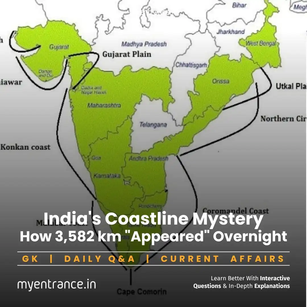
India’s coastline has undergone a remarkable transformation on paper, officially increasing by a staggering 3,582 kilometers – that’s nearly 48% longer than previously recorded! This dramatic jump, from the long-standing figure of 7,516 km (established in the 1970s) to a new official length of 11,098 km, isn’t due to territorial expansion or rising sea levels, but rather a leap forward in measurement accuracy.
Here’s what happened and why it matters:
The Power of Precision: The old measurement relied on much lower-resolution data (scale 1:4,500,000 or smaller). Imagine trying to trace a jagged coastline with a giant, blunt crayon – you’d miss countless small bays, inlets, and curves. The new measurement used vastly superior high-resolution data (scale 1:250,000). This is like switching to a fine-tipped pen, capturing intricate details previously smoothed over or ignored.
Smarter Tools: Modern Geographic Information System (GIS) software replaced older, manual calculation methods. GIS can handle complex spatial data with incredible precision, meticulously mapping every twist and turn of the shoreline that earlier techniques simply couldn’t capture efficiently.
Counting the Islands: The reassessment also included a more thorough count of India’s offshore islands. Many smaller islands were either invisible in the old, low-resolution data or were practically omitted due to manual limitations. Including their coastlines significantly added to the total length.
The Coastline Paradox: This phenomenon highlights a core challenge. Coastlines are naturally fractal – incredibly irregular at every scale. Think of it this way:
Measure with a 1-km ruler: You skip small coves and headlands, getting a shorter length.
Measure with a 1-meter ruler: You capture more bends, resulting in a longer length.
Measure with a 1-cm ruler: You capture even more microscopic irregularities, making the length longer still!
There is no single “true” length for such a complex natural feature. The measured length always depends on the scale and technology used. Our new measurement (11,098 km) is far more accurate than the old one, but it’s still not the “absolute” length – that’s mathematically elusive.
Ground Reality Unchanged: Crucially, this increase is purely a cartographic correction. There has been no physical change to India’s landmass or the actual shoreline. The land and sea meet exactly where they did before.
More Islands Too: Alongside the coastline extension, the official count of India’s islands also saw a slight increase due to this more accurate identification and cataloging process.
Why is this Important for Exams (SSC, PSC, UPSC, State Exams)?
This story hits multiple key areas across competitive exam syllabi:
Prelims (Geography): Directly relates to “Physical Geography of India” – specifically coastline features, measurement challenges, and the impact of technology.
Mains (GS-I): Covers “Important Geophysical phenomena” and “changes in critical geographical features.” It’s a perfect example of how our understanding and measurement of geographical features evolve with technology.
Current Affairs: A significant recent development in India’s geographical data.
General Knowledge: Tests understanding of basic geography concepts (coastline, islands) and the application of technology (GIS).
Conceptual Understanding: Illustrates abstract but important ideas like the coastline paradox, relevant for geography and even environmental science.
Sample Questions & Answers:
Q: What is the primary reason for India’s coastline length increasing from 7,516 km to 11,098 km?
A: The increase is due to more accurate measurement using high-resolution data (scale 1:250,000) and advanced GIS technology, capturing intricate details previously missed, not any physical change in territory.
Q: What is the ‘Coastline Paradox’ mentioned in the context of measuring India’s shoreline?
A: The coastline paradox states that the measured length of a naturally irregular coastline increases infinitely as the measurement scale becomes finer because more details (bays, inlets) are captured. There is no single “true” finite length.
Q: Besides better technology, what other factor contributed to the increased coastline length?
A: The inclusion of coastlines from numerous smaller offshore islands that were either not visible in older, low-resolution data or were omitted during previous manual surveys.
Q: Has the physical boundary of India changed due to this remeasurement?
A: No. The increase in measured length is purely a result of more precise cartography and data analysis. The actual land-sea boundary remains unchanged on the ground.
Q: Why is understanding this coastline remeasurement important from an administrative perspective?
A: Accurate coastline data is crucial for coastal zone management, disaster planning (cyclones, tsunamis), resource allocation, maritime security, boundary delineation, and environmental conservation efforts.
How to Smart Prepare for Entrance Exams in Less Time:
Cracking competitive exams demands strategy, especially when time is tight. Rote learning won’t cut it. Focus on high-yield areas and reliable resources:
Target the Most Predicted Questions: Don’t waste time on obscure topics. Focus on areas frequently asked in previous years and current trends. The most predicted questions provided by myentrance.in are the perfect place to concentrate your efforts efficiently. Our experts analyze patterns to give you the edge.
Master Last-Minute Revision: The final weeks are critical. Use concise, well-structured revision notes and practice papers designed for quick recall. Opt for last-minute preparation packages by myentrance.in – they streamline crucial concepts and updates into manageable chunks.
Conquer Current Affairs & GK: This is a massive scoring area across all exams. Stay updated with curated, exam-relevant news summaries. Rely on the dedicated current affairs and GK sections by myentrance.in. We filter the noise and deliver what truly matters for your exam.
Leverage Quality Mock Tests: Simulate the real exam environment. Analyze your performance to identify strengths and weaknesses. myentrance.in’s realistic mocks provide invaluable practice and detailed feedback.
Understand, Don’t Just Memorize: Especially for dynamic topics like geography and current events (like the coastline remeasurement!), focus on understanding the ‘why’ and ‘how’. This leads to better retention and application in diverse questions.
By combining strategic focus on predicted areas, efficient last-minute revision, up-to-date current affairs from trusted sources like myentrance.in, and targeted practice, you can maximize your score even with limited preparation time.
Most Predicted Questions
Comprehensive study materials, Expert-guided tips & tricks, Mock tests and instant results.
Start your SSC, NIFT, NID, FDDI, PSC journey today with MyEntrance, your ultimate online coaching platform.
Read More Topics