Translate Language
Why Does the Godavari River Flood? Unpacking Andhra Pradesh’s Annual Crisis
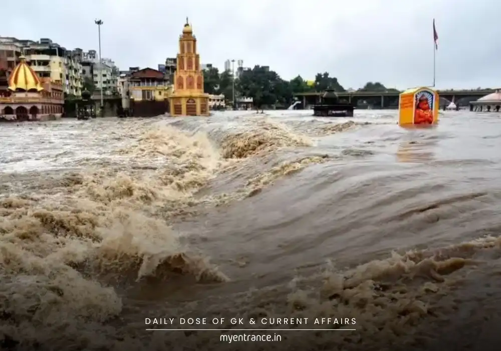
The Godavari River, India’s second-longest river, has unleashed devastating floods in Eluru district, Andhra Pradesh, forcing mass evacuations. Understanding why these floods occur is key for competitive exams and disaster management strategies. Let’s decode the science and geography behind this recurring crisis.
Why Does the Godavari River Flood?
The Perfect Storm of Geography & Climate
The Godavari’s floods stem from a complex interplay of natural and human factors:
Heavy Monsoon Rainfall: The river’s basin receives intense rainfall (June–September), especially in the Western Ghats. This water funnels into the Godavari and its 10+ tributaries, causing rapid swelling.
Triangular Basin Shape: Bounded by hills (Satmala, Eastern Ghats) and the Western Ghats, the basin acts like a funnel. Water from Maharashtra, Telangana, and Chhattisgarh converges into Andhra Pradesh, overwhelming the lower reaches near Eluru.
Siltation & Shallow Beds: Heavy sedimentation reduces the river’s depth, making it prone to overflowing during peak discharge.
Human Interventions: Dams (like Polavaram) manage water but can worsen floods if releases coincide with heavy rains. Urban encroachment on floodplains in cities like Nashik or Rajahmundry reduces natural absorption zones.
The Toll on Communities
Recent floods displaced thousands in Eluru, highlighting:
Inadequate flood infrastructure in delta regions.
Delayed evacuations despite IMD warnings.
Long-term economic damage to agriculture and housing.
Q&A for Competitive Exams
Q1: Why is the Godavari called the ‘Dakshin Ganga’?
A1: It mirrors the Ganges’ cultural significance in South India, hosting the Kumbh Mela at Nashik and spanning 7 states.
Q2: Name the left-bank tributaries of the Godavari.
A2: Purna, Pranhita, Indravati, Sabari, Wainganga, Wardha, and Penganga.
Q3: Which hills form the northern boundary of the Godavari basin?
A3: Satmala Hills, Ajanta Range, and Mahadeo Hills.
Q4: How do human activities exacerbate Godavari floods?
A4: Floodplain encroachment, deforestation in catchment areas, and uncoordinated dam water releases reduce natural drainage capacity.
Q5: Identify two major irrigation projects on the Godavari.
A5: Polavaram Irrigation Project (Andhra Pradesh) and Kaleshwaram Lift Irrigation Project (Telangana).
Get 3 Months Free Access for SSC, PSC, NIFT & NID
Boost your exam prep!
Use offer code WELCOME28 to get 3 months free subscription. Start preparing today!
Read More Topics