Translate Language
The Science Behind Cloudbursts: Why Uttarkashi Flooded
Cloudbursts are sudden, catastrophic deluges capable of unleashing billions of litres of rain in minutes, triggering deadly floods and landslides, especially in mountainous regions like the Himalayas. Understanding their formation mechanism is crucial for disaster management and geography sections in major competitive exams. The recent Uttarkashi tragedy tragically underscores their destructive power and exam relevance.
Imagine the atmosphere like a colossal sponge holding moisture. A cloudburst happens when this “sponge” is suddenly and violently squeezed over a very small area, typically 20-30 sq km, dumping an extraordinary amount of rain – 100 mm (10 cm) or more within an hour, often in just minutes. Here’s the step-by-step process, focusing on the Himalayan context so crucial for Indian exams:
Warm, Moist Air Charge: Winds, especially during monsoons, carry vast amounts of warm, water-laden air from the Bay of Bengal or Arabian Sea across the plains towards the mountains.
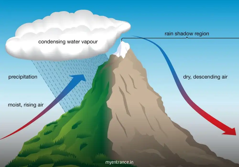
Forced Ascent (Orographic Lifting): When this moisture-heavy air slams into the steep slopes of ranges like the Himalayas, it has nowhere to go but upwards rapidly.
Rapid Cooling & Condensation: As the air surges upwards, it cools down quickly. This cooling forces the invisible water vapor to condense into countless tiny water droplets, forming dense, towering cumulonimbus clouds.
The Suspension & Growth Trap (Langmuir Mechanism): Inside these turbulent clouds, powerful updrafts (rising air currents) act like an invisible net, trapping the growing raindrops and preventing them from falling. Suspended aloft, these droplets collide and merge, growing into exceptionally large raindrops.
The Sudden Release (Cloudburst!): This precarious balance can’t last forever. When the updrafts weaken abruptly or can no longer support the immense weight of the accumulated water, the entire colossal mass of super-sized raindrops plummets to the ground simultaneously. This is the cloudburst – an intense, localized downpour of unimaginable ferocity.
Devastating Impact: The sheer volume is staggering – 100mm of rain means 100,000 litres of water per square metre! Over a small mountainous catchment (like Kheer Ganga in Uttarkashi), this translates to billions of litres of water crashing down in minutes. Mountainous terrain, with its narrow valleys and limited drainage, is overwhelmed instantly, leading to catastrophic flash floods and landslides.
Why Cloudbursts Prediction is Tough: The hyper-localized nature (hitting a very small area) and the sudden collapse of the updraft mechanism make cloudbursts extremely difficult to predict with current technology, posing a major challenge for early warnings.
Why is Understanding Cloudbursts Important for Exams?
Cloudbursts are a recurring, high-impact phenomenon in India, especially in the Himalayas. This makes them highly relevant for competitive exams:
Geography (GS Paper I – UPSC, PSC, KAS, SSC CGL): Directly covered under Physical Geography (Climatology, Monsoons, Landforms), Indian Geography (Himalayan features, Disaster Vulnerability), and Environmental Geography.
Disaster Management (GS Paper III – UPSC, PSC, KAS): Critical for understanding natural hazards, disaster preparedness, mitigation strategies, and challenges in early warning systems.
Environment & Ecology: Linked to climate change impacts on extreme weather events.
Current Affairs: Events like Uttarkashi are frequently asked, demanding knowledge of the underlying science.
Interdisciplinary Understanding: Connects meteorology, geography, environment, and disaster management – a hallmark of modern exam patterns.
Questions and Answers on Cloudbursts
Q: Define a cloudburst. What rainfall threshold characterizes it?
A: A cloudburst is an extreme weather event involving sudden, exceptionally intense rainfall over a small geographical area (typically 20-30 sq km). It is characterized by rainfall equal to or exceeding 100 millimeters (10 centimeters) within a very short duration, often less than an hour, sometimes concentrated in just minutes.
Q: Explain the primary mechanism responsible for cloudburst formation in the Himalayas.
A: The primary mechanism is Orographic Lifting. Warm, moisture-laden monsoon winds from the Bay of Bengal/Arabian Sea are forced to rise rapidly upon encountering the steep Himalayan slopes. This rapid ascent causes intense cooling, condensation, and the formation of massive rain clouds. Updrafts suspend raindrops, allowing them to grow large, before a sudden collapse releases them as a cloudburst.
Q: What is the Langmuir precipitation mechanism, and how does it contribute to a cloudburst?
A: The Langmuir precipitation mechanism refers to the process within a thundercloud where strong updrafts keep raindrops suspended aloft for an extended period. During this suspension, the raindrops collide and coalesce, merging into exceptionally large drops. When these updrafts eventually weaken or fail, the accumulated mass of these oversized raindrops plummets to the ground all at once, causing the intense, short-duration deluge characteristic of a cloudburst.
Q: Why are cloudbursts particularly devastating in mountainous regions like Uttarakhand? (Mention at least 2 reasons)
A: Cloudbursts are devastating in mountains due to: (i) Steep Slopes & Narrow Valleys: These accelerate rainwater runoff, preventing absorption and channeling immense volumes into narrow gorges with tremendous force. (ii) Loose Soil/Rock: Saturation from sudden rain triggers landslides and debris flows, amplifying the destruction. (iii) Limited Drainage Capacity: Mountain streams and rivers cannot handle the billion-litre influx in minutes, causing immediate flash flooding.
Q: Why are cloudbursts notoriously difficult to predict, posing a challenge for disaster management?
A: Cloudbursts are hard to predict because: (i) Extreme Localization: They affect a very small area (20-30 sq km), making precise location forecasting difficult with current weather models. (ii) Sudden Onset: The collapse of the updraft suspending the rain happens rapidly and is hard to detect in advance. (iii) Complex Terrain: Mountainous topography creates highly variable microclimates that challenge accurate rainfall intensity modeling.
Get 3 Months Free Access for SSC, PSC, NIFT & NID
Boost your exam prep!
Use offer code WELCOME28 to get 3 months free subscription. Start preparing today!
Read More Topics