Translate Language
Kamchatka Earthquake Deep Dive: Tectonics, Tsunami & Exam Relevance (SSC/UPSC/PSC)
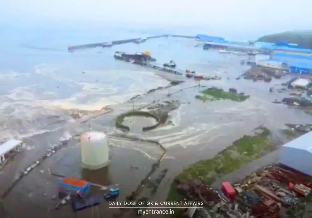
A powerful 8.8 magnitude earthquake recently rocked Russia’s Kamchatka Peninsula, sending tsunami waves across the Pacific. This event underscores the immense seismic activity of the “Ring of Fire,” a fundamental concept for geography sections in exams like UPSC, SSC, and PSC. Understanding why Kamchatka shakes is key to grasping global geophysical phenomena.
The Kamchatka Earthquake: A Ring of Fire Event
Imagine the ground violently shaking in one of Earth’s most remote corners. That’s what happened recently when a colossal 8.8 magnitude earthquake struck the Kamchatka Peninsula in Russia’s Far East. This wasn’t just any tremor; it was one of the strongest recorded globally in recent decades, triggering tsunami waves that reached several Pacific nations, including Japan and Hawaii. While thankfully causing no major loss of life this time, it served as a stark reminder of our planet’s dynamic and powerful forces.
Why Kamchatka? The Mighty Ring of Fire
The key lies in Kamchatka’s location. It sits squarely on the Circum-Pacific Belt, far better known as the “Ring of Fire.” Picture a horseshoe-shaped zone stretching almost 40,000 kilometers around the Pacific Ocean. This belt is the undisputed champion of seismic and volcanic activity on Earth. Think of it as the planet’s most active geological fault line.
The Ring’s Reach: It touches the west coasts of North and South America (like the US, Chile), crosses the Pacific to include Japan, the Philippines, Indonesia, New Zealand, and loops up through the Kuril Islands to Kamchatka and Alaska.
Why So Active? The Ring of Fire isn’t random. It’s where several massive tectonic plates collide. Specifically, the dense oceanic plates of the Pacific are relentlessly pushing under (a process called subduction) the lighter continental plates of Asia and the Americas.
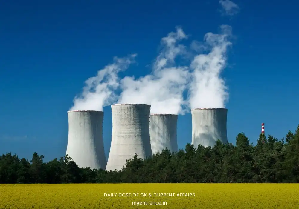
The Subduction Effect: As the Pacific plate grinds downward, immense stress builds up along these plate boundaries. When the pressure finally overcomes the friction holding the rocks together, it snaps – releasing catastrophic energy as an earthquake. This subduction is also responsible for the chain of volcanoes lining the Ring.
The Unpredictable Power of Earthquakes
Despite knowing where earthquakes are likely (like the Ring of Fire), predicting exactly when they will strike remains one of science’s biggest challenges. Here’s why:
Focus and Epicenter: The rupture starts deep underground at the hypocenter (or focus). The point directly above it on the Earth’s surface is the epicenter, where shaking is usually most intense.
Shallow vs. Deep: Earthquakes near the surface (shallow focus) often cause more damage than deeper ones of the same magnitude, as the energy doesn’t dissipate as much before reaching us.
Tsunami Trigger: When a powerful earthquake happens under the ocean, especially one involving sudden vertical movement of the seafloor during subduction, it can displace vast amounts of water, generating a devastating tsunami.
A History of Seismic Fury
The recent Kamchatka quake was a rare giant, but the region is no stranger to violent shaking:
This was the strongest quake globally since Japan’s 2011 magnitude 9.1 disaster (which caused the Fukushima nuclear crisis).
The Ring of Fire accounts for a staggering over 80% of the world’s largest earthquakes, including the record-breaking magnitude 9.5 Chile quake (1960) and the magnitude 9.2 Alaska quake (1964).
The zone stretching from Kamchatka down to Japan has experienced more than 130 major earthquakes (magnitude 7+) since 1900, including a magnitude 9 event in 1952.
Why is this Important for Exams (SSC, PSC, UPSC, KAS, etc.)?
This topic hits multiple crucial areas of competitive exam syllabi:
Prelims Geography (Indian & World – Physical): Directly covers major geophysical phenomena (earthquakes, tsunamis, volcanoes), global seismic zones (especially the Ring of Fire), plate tectonics, and subduction processes. Map-based questions on earthquake-prone areas, the Ring of Fire, and plate boundaries are common.
Mains GS-I (Geophysical Phenomena): Provides a concrete case study for discussing “Important Geophysical phenomena such as earthquakes, Tsunami, Volcanic activity.” Explains the causes (plate tectonics, subduction), effects (tsunamis, landscape changes), and unpredictability of earthquakes. Relates directly to “geographical features and their location.”
Disaster Management: Understanding earthquake causes and zones is foundational for discussing pre-disaster (building codes, early warning systems, public awareness) and post-disaster management strategies.
Current Affairs Linkage: Major seismic events often feature in current affairs, requiring understanding of their geographical and scientific context.
Questions & Answers on Kamchatka Earthquakes :
Q: What is the ‘Ring of Fire’, and why is the Kamchatka Peninsula particularly vulnerable to earthquakes? (Prelims/Conceptual)
A: The Ring of Fire is a horseshoe-shaped belt around the Pacific Ocean, marked by intense seismic and volcanic activity. Kamchatka Peninsula lies directly on this belt, where the Pacific tectonic plate subducts (dives beneath) the Eurasian plate. This collision and grinding motion build up immense stress, released as powerful earthquakes.
Q: Differentiate between the ‘focus’ and the ‘epicenter’ of an earthquake. (Prelims/Definition)
A: The focus (or hypocenter) is the actual point underground where the earthquake rupture originates. The epicenter is the point on the Earth’s surface directly above the focus. Shaking intensity is usually strongest at the epicenter.
Q: How does the process of subduction lead to both earthquakes and tsunamis? (Mains/Cause-Effect)
A: Subduction occurs when one tectonic plate (usually denser oceanic crust) is forced beneath another. The immense friction and stress at the plate boundary can cause sudden slippage, triggering a massive earthquake. If this earthquake occurs under the ocean and involves significant vertical displacement of the seafloor, it displaces a huge volume of water, generating tsunami waves.
Q: Why is the Circum-Pacific Belt responsible for the majority of the world’s largest earthquakes? (Prelims/Mains – Analysis)
A: The Circum-Pacific Belt (Ring of Fire) is the primary location where several major tectonic plates (Pacific, Nazca, Cocos, Philippine Sea, Juan de Fuca) are actively subducting beneath continental plates (Eurasian, North American, South American, Indo-Australian). This constant, large-scale collision and grinding at plate boundaries generate the enormous stresses released in the world’s most powerful earthquakes. Over 80% of major quakes occur here.
Q: What are the key challenges in predicting earthquakes, despite knowing high-risk zones like the Ring of Fire? (Mains – Critical Analysis)
A: While we identify seismically active zones (like the Ring of Fire) based on plate tectonics, precise prediction remains elusive due to:
The extreme complexity and depth of forces within the Earth’s crust.
Inability to directly measure the exact stress build-up along fault lines before rupture.
Lack of clear, universal precursors (warning signs) that reliably occur before every major quake.
The chaotic nature of fracture processes deep underground. Current efforts focus on hazard assessment (likelihood over time) and early warning (seconds after rupture starts), not exact prediction.
Get 3 Months Free Access for SSC, PSC, NIFT & NID
Boost your exam prep!
Use offer code WELCOME28 to get 3 months free subscription. Start preparing today!
Read More Topics