Understanding India’s Disaster Response Through Recent Events
In the dynamic landscape of competitive examinations like UPSC, SSC, PSC, and other government recruitment tests, a thorough understanding of current affairs is not just an added advantage, but a fundamental necessity. Events unfolding daily often serve as practical case studies for theoretical concepts covered in your syllabus. The recent severe weather events and subsequent government response in regions like Himachal Pradesh and Punjab offer a prime example, providing invaluable insights into India’s disaster management framework, geographical vulnerabilities, and the Union Government’s role in state-level crises. Regular daily mcq practice on current events is key to scoring well in the gk section.
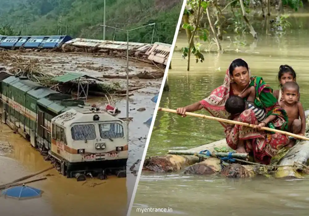
The Context: Unpacking Recent Natural Calamities
India frequently experiences the brunt of natural disasters, with monsoon-related phenomena such as floods, landslides, and heavy rainfall posing significant challenges, particularly in the ecologically sensitive Himalayan and sub-Himalayan regions. Recently, Himachal Pradesh and Punjab faced devastating deluges, leading to widespread disruption, loss of infrastructure, and considerable economic impact. Such events not only test the resilience of affected communities but also the efficacy of governmental machinery in rapid response and recovery. Understanding the ‘what’ and ‘when’ of these occurrences—the affected regions, the nature of the calamity, and the timeline of government intervention—forms the bedrock of your current affairs preparation.
The Government’s Response: A Case Study in Disaster Management
Following significant natural disasters, the national leadership often steps in to assess the situation firsthand, providing a visible demonstration of commitment and support. The Prime Minister’s aerial reconnaissance of the affected areas in Himachal Pradesh and Punjab served as a critical step in understanding the on-ground realities and the extent of the damage. This aerial survey, coupled with high-level review meetings with state government officials, is a standard operating procedure for evaluating the crisis, assessing losses, and strategizing relief and rehabilitation efforts. Furthermore, the announcement of substantial financial assistance underscores the central government’s role in augmenting state resources during times of severe distress, aiming to facilitate swift recovery and reconstruction. This aspect directly ties into topics like federalism, inter-governmental cooperation, and the mechanisms of disaster funding vital for General Studies papers. Follow this last-minute study plan for aspirants to structure your final hours of study.
Geographical and Policy Dimensions for Exam Success
For aspirants of UPSC and other civil services exams, this situation presents a multifaceted learning opportunity. From a geographical perspective, the vulnerability of Himachal Pradesh to landslides and flash floods during the monsoon highlights concepts like physiography, climate, and environmental degradation in the Himalayan region. For Punjab, the focus might shift to riverine floods and their impact on agricultural plains. In terms of policy and governance, it illuminates the functioning of the National Disaster Management Authority (NDMA), the State Disaster Response Force (SDRF), and the National Disaster Response Fund (NDRF). Questions might arise regarding the legislative framework for disaster management in India, the role of various ministries, or the socio-economic impacts of such disasters. Analyzing the ‘how’ and ‘why’ behind government actions—the choice of an aerial survey, the decision to hold review meetings, and the allocation of aid—provides a deeper understanding that goes beyond mere factual recall, preparing you for analytical and opinion-based questions.
Why This Matters for Your Exams
Every major national event, particularly those involving natural disasters and government intervention, is a potential goldmine for competitive exam questions. You could face questions on:
* Current Affairs: Specific details about the affected states, the type of disaster, and the government’s immediate actions.
* Indian Geography: Monsoon patterns, causes of landslides, river systems, and environmental vulnerability.
* Indian Polity & Governance: Federal structure, roles of central and state governments in disaster management, constitutional provisions for financial assistance to states.
* Economy: Economic impact of disasters, relief packages, and their funding mechanisms.
* General Studies (GS Mains): Comprehensive questions on disaster management policies, climate change impacts, and strategies for mitigation and adaptation.
By approaching news with an analytical lens, connecting events to your syllabus, and understanding the ‘why’ behind the ‘what,’ you transform passive reading into active, exam-oriented learning. MyEntrance.in helps you make these crucial connections, equipping you to ace your examinations with confidence.
Frequently Asked Questions (FAQs)
Q1: Why is understanding government response to natural disasters important for competitive exams?
A1: It’s crucial because it tests your knowledge of current affairs, India’s geographical vulnerabilities, the federal structure, disaster management policies (NDMA, NDRF), and the economic implications of such events, all of which are key components of various exam syllabi like UPSC, SSC, and PSC.
Q2: Which central government bodies are primarily responsible for disaster management in India?
A2: The National Disaster Management Authority (NDMA), headed by the Prime Minister, is the apex body. It works in conjunction with the Ministry of Home Affairs, the National Disaster Response Force (NDRF), and State Disaster Management Authorities (SDMAs) to coordinate preparedness, response, and recovery efforts.
Q3: How do natural calamities like floods and landslides in the Himalayas relate to topics in Indian Geography for exams?
A3: These events are directly linked to topics like physiography of India (Himalayan landforms), monsoon climate patterns, river systems, erosion, deforestation, and the concept of environmental vulnerability, all of which are frequently tested in the Indian Geography section of competitive exams.
Q4: What is the significance of the Prime Minister conducting an aerial survey during a disaster?
A4: An aerial survey allows for a rapid and comprehensive assessment of the scale of damage across a wide area. It signifies the central government’s direct involvement and commitment, helps in allocating resources effectively, and often precedes the announcement of financial assistance or specific relief measures, setting a precedent for coordinated national response.
Q5: How is financial assistance usually provided to states affected by natural disasters, and what funds are involved?
A5: Financial assistance is typically provided from the National Disaster Response Fund (NDRF), which supplements the State Disaster Response Fund (SDRF). The allocation is based on the severity of the disaster and a detailed assessment of damages, often involving recommendations from inter-ministerial central teams. This mechanism highlights the financial aspects of disaster management, a relevant topic for both Economy and Polity sections.