Select Medium
CLASS X SOCIAL SCIENCE 2 CHAPTER 6
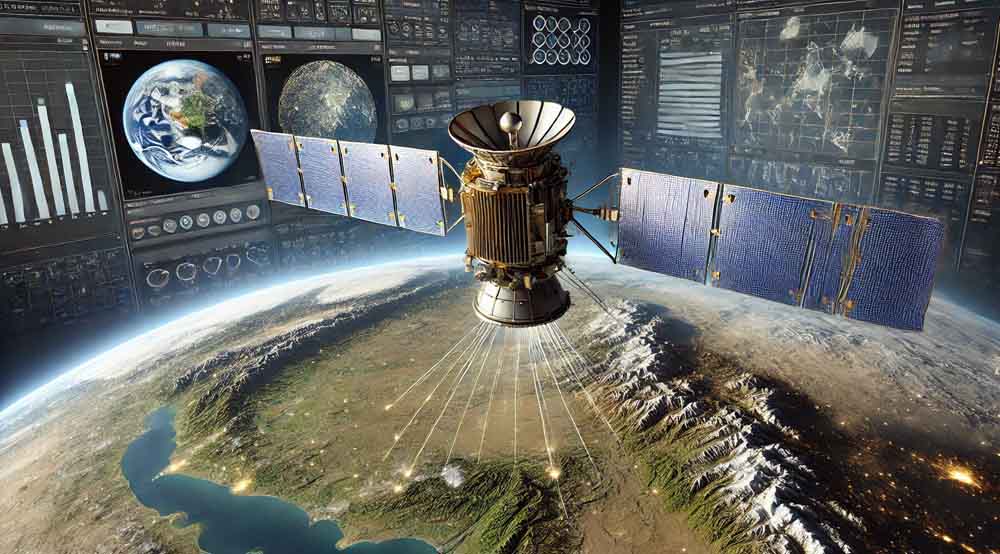
Eyes in The Sky and Data Analysis
LESSON OVERVIEW
Satellite technology, combined with advanced computer software, plays a crucial role in the analysis of geospatial data, enabling detailed mapping and monitoring of Earth’s surface. By integrating remote sensing with Geographic Information Systems (GIS), we can capture, analyze, and visualize spatial data for various applications. This synergy between satellites and software enhances our understanding of the planet and supports informed decision-making in fields such as environmental management, urban planning, and disaster response.
1. Remote Sensing
Description:
Remote sensing is the science of obtaining information about objects or areas from a distance, typically from aircraft or satellites. This technology involves the detection and measurement of radiation of different wavelengths reflected or emitted from distant objects or surfaces, which is then used to observe and analyze the Earth’s surface. Remote sensing allows us to collect data on large and inaccessible areas, making it invaluable for environmental monitoring, urban planning, disaster management, and various scientific research applications.
Examples:
Remote sensing is used to monitor deforestation in the Amazon rainforest, track the melting of polar ice caps, assess crop health in agriculture, and map urban sprawl in rapidly growing cities.
Additional Information:
Remote sensing can be divided into two main types: active and passive. Active remote sensing involves sending out a signal (such as radar) and measuring what is reflected back, while passive remote sensing measures natural radiation that is emitted or reflected by the objects.
Tip for Remembering:
Think of “remote” as distant and “sensing” as gathering information; thus, remote sensing is about gathering information from a distance.
________________________________________
2. Sensors in Remote Sensing
Description:
Sensors in remote sensing are devices that detect and measure physical properties of the Earth’s surface and atmosphere. These sensors can be mounted on satellites, aircraft, or even on the ground. They measure a wide range of data, including temperature, humidity, vegetation cover, water bodies, and urban development, across different electromagnetic spectrum bands.
Examples:
Common sensors include the Landsat satellite sensors for Earth observation, the Moderate Resolution Imaging Spectroradiometer (MODIS) on NASA’s Terra and Aqua satellites, and synthetic aperture radar (SAR) systems used for terrain mapping and monitoring.
Additional Information:
Sensors can be categorized based on the wavelength regions they operate in, such as optical sensors (visible and near-infrared), thermal sensors (infrared), and microwave sensors (radar). Each type of sensor is suited to specific applications depending on the kind of data required.
Tip for Remembering:
Think of sensors as the eyes of the satellites or aircraft, detecting and recording what they “see” on Earth.
________________________________________
3. Classification of Remote Sensing Based on Source of Energy: Passive and Active Remote Sensing
Description:
Remote sensing can be classified into passive and active types based on the source of energy used to detect and record information. Passive remote sensing relies on natural energy, typically sunlight, to illuminate the object of interest. The sensor then detects the reflected or emitted radiation from the object. Active remote sensing, on the other hand, involves sending out energy from the sensor itself, usually in the form of a laser or microwave, and then measuring the energy that is reflected back from the object.
Examples:
• Passive Remote Sensing: Aerial photography, satellite imaging in the visible and infrared spectrum.
• Active Remote Sensing: Radar systems, LIDAR (Light Detection and Ranging) systems.
Additional Information:
Passive remote sensing is dependent on sunlight, making it limited to daylight hours and clear weather conditions. Active remote sensing can be conducted at any time of day and in various weather conditions, as it generates its own source of energy.
Tip for Remembering:
“Passive” means it uses existing natural energy, while “active” means it actively sends out energy to gather data.
________________________________________
4. Terrestrial Photography
Description:
Terrestrial photography involves taking photographs from a ground-based position to capture detailed views of the Earth’s surface. It is one of the oldest forms of remote sensing and is often used to complement data from aerial and satellite remote sensing. Terrestrial photography provides high-resolution, close-up images that can be used to study small areas in great detail.
Examples:
Photographs taken during field surveys, documenting environmental changes such as soil erosion, vegetation growth, or construction development.
Additional Information:
While terrestrial photography is highly detailed, it is limited in coverage compared to aerial or satellite remote sensing. It is often used for validating remote sensing data or for detailed studies where precision is required.
Tip for Remembering:
“Terrestrial” means related to Earth, so terrestrial photography is Earth-based, ground-level photography.
________________________________________
5. Aerial Remote Sensing
Description:
Aerial remote sensing involves capturing data from sensors mounted on aircraft. This form of remote sensing is useful for obtaining high-resolution images of the Earth’s surface over smaller areas compared to satellite remote sensing. Aerial remote sensing can provide detailed information for mapping, agriculture, forestry, and urban planning.
Examples:
Aerial photography for topographic mapping, airborne LIDAR used in forestry to assess tree height and biomass, and infrared imaging to monitor vegetation health.
Additional Information:
Aerial remote sensing can be more flexible than satellite remote sensing because aircraft can be deployed quickly and can fly at different altitudes, depending on the required resolution. However, it is generally more expensive and less able to cover large areas compared to satellite-based methods.
Tip for Remembering:
“Aerial” relates to the air, so think of aircraft-based sensing when you think of aerial remote sensing.
________________________________________
6. Satellite Remote Sensing
Description:
Satellite remote sensing is the process of acquiring information about the Earth’s surface using sensors mounted on satellites. It is particularly useful for monitoring large and remote areas, providing continuous and repetitive coverage of the Earth. This technology is crucial for weather forecasting, environmental monitoring, disaster management, and global change research.
Examples:
Landsat satellites for environmental monitoring, NOAA satellites for weather forecasting, and Sentinel satellites for agricultural and land use analysis.
Additional Information:
Satellite remote sensing offers a variety of data types, including optical imagery, thermal imaging, and radar, each suited to different applications. Satellites can be geostationary, providing constant coverage of a particular area, or sun-synchronous, passing over the same region at the same local solar time for consistent lighting conditions.
Tip for Remembering:
“Satellite” indicates space-based, so satellite remote sensing refers to data collected from space to monitor Earth.
________________________________________
7. Overlap in Aerial Photographs
Description:
Overlap in aerial photographs refers to the intentional overlap of images captured in sequence from an aircraft. This overlap is critical for creating a continuous image mosaic and for enabling stereoscopic vision, which allows for the creation of three-dimensional models of the Earth’s surface.
Examples:
In aerial surveys, each photograph overlaps the previous one by about 60% along the flight path and by about 30% between adjacent flight lines to ensure full coverage and enable 3D analysis.
Additional Information:
Overlap is essential for accurate mapping and topographic analysis. It also ensures that no area is left unphotographed, which is crucial for applications like terrain modeling, land use planning, and environmental monitoring.
Tip for Remembering:
Think of overlap as “overlapping” images to ensure no gaps and to allow for 3D mapping.
________________________________________
8. Stereo Pair
Description:
A stereo pair consists of two overlapping aerial photographs taken from slightly different angles. When these images are viewed together through a stereoscope, they create a three-dimensional effect, allowing for the visualization of terrain features in depth. This technique is widely used in photogrammetry and topographic mapping.
Examples:
Stereo pairs are used in forestry to measure tree height, in geology to map terrain features, and in urban planning to analyze building heights and land use.
Additional Information:
The creation of stereo pairs is based on the principle of parallax, where the displacement between two overlapping images taken from different positions provides depth perception. This technique is fundamental in applications requiring accurate elevation data.
Tip for Remembering:
“Stereo” suggests 3D (like stereo sound) and “pair” means two, so a stereo pair refers to two images creating a 3D effect.
________________________________________
9. Stereoscope
Description:
A stereoscope is a device used to view stereo pairs of photographs. By allowing each eye to view a different image of the pair, the stereoscope creates the illusion of depth, enabling the observer to perceive the three-dimensional structure of the terrain. Stereoscopes are essential tools in photogrammetry, used extensively in topographic mapping and terrain analysis.
Examples:
Stereoscopes are used in forestry to estimate tree heights, in geology to study landforms, and in military applications for analyzing terrain features.
Additional Information:
There are various types of stereoscopes, including pocket stereoscopes for fieldwork and mirror stereoscopes for more detailed office work. The use of stereoscopes is crucial in environments where accurate elevation and depth perception are necessary.
Tip for Remembering:
“Stereo” means 3D, and “scope” means viewing device, so a stereoscope is a device for viewing images in 3D.
________________________________________
10. Stereoscopic Vision
Description:
Stereoscopic vision refers to the ability to perceive depth and three-dimensional structure from two slightly different images, one viewed by each eye. In remote sensing, stereoscopic vision is used to create 3D models of terrain by analyzing stereo pairs of aerial or satellite photographs.
Examples:
Stereoscopic vision is used in topographic mapping, urban planning, and environmental monitoring to accurately model the Earth’s surface and its features.
Additional Information:
Stereoscopic vision is a crucial tool in photogrammetry, allowing for the measurement of heights, depths, and volumes in three dimensions. This capability is essential for accurate terrain modeling and for applications such as flood risk assessment, infrastructure planning, and resource management.
Tip for Remembering:
“Stereo” indicates 3D, and “vision” refers to seeing, so stereoscopic vision is seeing in 3D.
________________________________________
11. Geostationary Satellites
Description:
Geostationary satellites orbit the Earth at the same speed as the Earth’s rotation, making them appear stationary relative to a fixed point on the Earth’s surface. Positioned at approximately 35,786 kilometers above the equator, these satellites provide continuous coverage of the same geographic area, making them ideal for telecommunications, weather monitoring, and broadcasting.
Examples:
• Weather Monitoring: The GOES (Geostationary Operational Environmental Satellite) series provides real-time weather data for the United States.
• Telecommunications: Satellites such as Inmarsat provide global communication services, including satellite phones and internet.
Additional Information:
Because they maintain a fixed position relative to the Earth, geostationary satellites are crucial for applications that require constant monitoring of a specific area. Their ability to provide continuous, real-time data is invaluable for weather forecasting, disaster management, and broadcasting services.
Tip for Remembering:
“Geo” means Earth, and “stationary” means not moving, so geostationary satellites stay fixed relative to a point on Earth.
________________________________________
12. Sun-Synchronous Satellites
Description:
Sun-synchronous satellites orbit the Earth in such a way that they pass over the same region at approximately the same local solar time. This consistent lighting condition is ideal for monitoring changes in the Earth’s surface over time, such as vegetation growth, urban development, and climate change. These satellites typically have a polar orbit, covering the entire Earth’s surface as the planet rotates.
Examples:
• Earth Observation: The Landsat series and Sentinel satellites are sun-synchronous, providing consistent imaging for environmental monitoring.
• Climate Monitoring: Satellites like Terra and Aqua, part of NASA’s Earth Observing System (EOS), provide data on the Earth’s climate and weather patterns.
Additional Information:
The consistent lighting conditions provided by sun-synchronous satellites make them ideal for time-series analysis, where changes in the Earth’s surface need to be monitored consistently over time. This orbit also allows these satellites to capture images of the entire Earth’s surface over a short period.
Tip for Remembering:
“Sun-synchronous” means synchronized with the Sun, so these satellites provide consistent lighting for imaging.
________________________________________
13. Spectral Signature of Objects
Description:
A spectral signature is the specific pattern of wavelengths of light that an object reflects, absorbs, or emits. These signatures are unique to different materials and are used in remote sensing to identify and classify objects on the Earth’s surface. For example, healthy vegetation has a distinct spectral signature that differs from stressed vegetation or bare soil.
Examples:
• Vegetation Monitoring: Spectral signatures help differentiate between various types of vegetation, assess crop health, and monitor forest cover.
• Mineral Exploration: Spectral signatures are used to identify different types of minerals and rocks in geological surveys.
Additional Information:
Spectral signatures are fundamental in remote sensing because they allow for the identification of materials and objects based on their interaction with different wavelengths of light. This capability is crucial for applications such as land cover classification, environmental monitoring, and resource exploration.
Tip for Remembering:
“Spectral” relates to light, and “signature” means a unique identifier, so a spectral signature is a unique light pattern.
________________________________________
14. Satellite Imageries
Description:
Satellite imageries are images of the Earth captured by sensors on satellites. These images provide valuable data for a wide range of applications, including environmental monitoring, urban planning, agriculture, and disaster management. Satellite imagery can capture data across various wavelengths, from visible light to infrared and microwave, allowing for detailed analysis of the Earth’s surface.
Examples:
• Environmental Monitoring: Satellite imagery is used to track deforestation, monitor water bodies, and assess the impact of natural disasters.
• Urban Planning: Cities use satellite imagery to monitor urban sprawl, plan infrastructure, and manage land use.
Additional Information:
Satellite imagery can be processed and analyzed to extract meaningful information, such as changes in vegetation cover, soil moisture levels, and land use patterns. The resolution of the imagery can vary from high-resolution images that capture fine details to low-resolution images used for broader, regional analyses.
Tip for Remembering:
“Satellite” indicates space-based, and “imageries” means images, so satellite imageries are images from space for analysis.
________________________________________
15. Spatial Resolution of the Sensor
Description:
Spatial resolution refers to the smallest object that can be detected by a remote sensing sensor. It determines the level of detail that can be seen in an image. Higher spatial resolution means the sensor can detect smaller details, making it ideal for applications requiring fine detail, such as urban planning and precision agriculture. Lower spatial resolution is used for broader, less detailed mapping.
Examples:
• High Spatial Resolution: Imagery from the WorldView-3 satellite, which has a spatial resolution of 31 cm, is used for detailed urban mapping and infrastructure monitoring.
• Low Spatial Resolution: Imagery from the MODIS sensor on NASA’s Terra and Aqua satellites, with a spatial resolution of 250 m to 1 km, is used for large-scale environmental monitoring.
Additional Information:
Spatial resolution is an important factor in remote sensing as it directly impacts the level of detail and accuracy of the data. The choice of spatial resolution depends on the specific application and the scale of the area being studied.
Tip for Remembering:
“Spatial” relates to space or area, and “resolution” means clarity or detail, so spatial resolution is the detail of space or area captured.
________________________________________
16. Uses of Remote Sensing Technology
Description:
Remote sensing technology is used in a wide range of applications, providing critical data for environmental monitoring, disaster management, urban planning, agriculture, and more. It enables the collection of data over large and inaccessible areas, offering a unique perspective that is invaluable for scientific research and decision-making.
Examples:
• Environmental Monitoring: Remote sensing is used to track deforestation, monitor water quality, and assess the impact of climate change.
• Disaster Management: It provides real-time data for monitoring natural disasters such as floods, earthquakes, and hurricanes, aiding in timely response and recovery efforts.
• Urban Planning: Remote sensing helps in monitoring urban growth, planning infrastructure, and managing land use.
Additional Information:
The versatility of remote sensing makes it an essential tool in many fields. Its ability to provide consistent, repeatable data over time allows for the monitoring of changes and trends, supporting long-term planning and management.
Tip for Remembering:
“Remote” means distant, and “sensing” means detecting, so remote sensing is detecting information from a distance, useful in various fields.
________________________________________
17. Geographic Information System (GIS)
Description:
A Geographic Information System (GIS) is a computer-based tool that integrates, stores, analyzes, and visualizes spatial and non-spatial data. GIS is used to capture, manage, analyze, and display all forms of geographically referenced information. It allows users to visualize, question, and interpret data to understand relationships, patterns, and trends.
Examples:
• Urban Planning: GIS is used to plan infrastructure, analyze urban growth, and manage land use.
• Environmental Management: GIS helps monitor natural resources, assess environmental impact, and plan conservation efforts.
• Public Health: GIS is used to track disease outbreaks, manage healthcare resources, and analyze the spatial distribution of health-related issues.
Additional Information:
GIS integrates spatial data (such as maps) with attribute data (such as names, types, and other descriptive information) to provide a comprehensive view of an area or issue. Its analytical capabilities, such as overlay analysis, buffer analysis, and network analysis, allow for complex spatial analysis and decision-making.
Tip for Remembering:
GIS is like a layered map where different data layers are combined to provide a comprehensive analysis.
________________________________________
18. Spatial Data
Description:
Spatial data, also known as geospatial data, refers to information about the location and shape of geographic features and the relationships between them. This data is the foundation of GIS, allowing users to map and analyze physical spaces and understand spatial relationships.
Examples:
• Mapping Land Use: Spatial data is used to create maps showing different land uses, such as residential, commercial, and agricultural areas.
• Transportation Planning: Spatial data is used to map roads, railways, and public transportation networks.
Additional Information:
Spatial data is often represented as points, lines, and polygons in GIS, with each feature corresponding to a real-world object, such as a building, road, or lake. The accuracy and precision of spatial data are crucial for effective GIS analysis.
Tip for Remembering:
“Spatial” means space or location, so spatial data is data about geographic locations.
________________________________________
19. Attributes in GIS
Description:
Attributes in GIS refer to the detailed information about spatial features. While spatial data tells us “where” something is, attributes tell us “what” it is. Attributes can include names, types, sizes, and other descriptive information about geographic features.
Examples:
• City Planning: Attributes might include the population of different city districts, the types of buildings, or the land use categories.
• Environmental Studies: Attributes could include the types of vegetation, soil composition, or water quality in different areas.
Additional Information:
Attributes are stored in tables linked to spatial data in a GIS database. This linkage allows for powerful analysis, as users can query and analyze the data based on specific attributes, helping in decision-making and planning.
Tip for Remembering:
“Attributes” are descriptive details, so they describe features in a GIS.
________________________________________
20. Layers in GIS
Description:
Layers in GIS refer to the different levels of data that can be stacked on top of one another to create a comprehensive map. Each layer represents a different type of information, such as roads, rivers, land use, or elevation. By combining multiple layers, GIS users can analyze the relationships between different features.
Examples:
• Urban Planning: Layers might include buildings, roads, utility lines, and zoning information.
• Environmental Conservation: Layers could include vegetation cover, water bodies, protected areas, and wildlife habitats.
Additional Information:
Using layers allows GIS to integrate diverse datasets into a single, coherent analysis. This layered approach makes it possible to study complex interactions and relationships in the data, supporting informed decision-making in various fields.
Tip for Remembering:
Think of GIS layers like layers of a cake, each adding valuable information.
________________________________________
21. Analytical Capabilities of GIS
Description:
GIS offers powerful analytical capabilities that allow users to perform complex spatial analysis and solve geographic problems. These capabilities include overlay analysis, buffer analysis, and network analysis, among others. GIS analysis helps in understanding spatial patterns, relationships, and trends, aiding in decision-making and planning.
Examples:
• Overlay Analysis: Combining land use and flood risk maps to identify areas at risk.
• Buffer Analysis: Creating buffer zones around rivers to protect against pollution.
• Network Analysis: Optimizing transportation routes to reduce travel time and costs.
Additional Information:
The analytical capabilities of GIS are essential for solving real-world problems. By integrating spatial and attribute data, GIS allows users to model scenarios, predict outcomes, and make data-driven decisions. This makes GIS a valuable tool in fields such as urban planning, environmental management, and logistics.
Tip for Remembering:
GIS analysis is like solving a puzzle, with each tool helping to piece together a clearer picture.
________________________________________
22. Overlay Analysis
Description:
Overlay analysis in GIS involves superimposing multiple layers of data to identify relationships and patterns. This technique is used to analyze how different factors interact in a given area, providing insights that are not apparent from individual layers. Overlay analysis is widely used in urban planning, environmental management, and resource allocation.
Examples:
• Urban Planning: Combining land use, zoning, and transportation layers to determine the best location for new infrastructure.
• Environmental Management: Overlaying vegetation and soil maps to identify areas suitable for reforestation.
Additional Information:
Overlay analysis is one of the most powerful tools in GIS, allowing for the integration of diverse data sources to support complex decision-making. It can be used to identify areas of overlap, conflict, or synergy between different factors.
Tip for Remembering:
Think of overlay analysis as layering one thing over another to see how they interact.
________________________________________
23. Buffer Analysis
Description:
Buffer analysis in GIS involves creating zones around a spatial feature, such as a point, line, or area, to analyze the surrounding environment within a specified distance. Buffers are used to identify areas that are within a certain proximity to a feature and to assess the impact or influence of that feature on its surroundings.
Examples:
• Environmental Studies: Creating buffer zones around rivers to protect water quality from nearby land use activities.
• Urban Planning: Analyzing the impact of noise pollution by creating buffers around highways.
Additional Information:
Buffer analysis is a valuable tool for planning and management. It helps in identifying areas that require protection, regulation, or special attention based on their proximity to critical features. Buffers can be simple (fixed distance) or complex (varying distances based on attributes).
Tip for Remembering:
Think of a buffer as a safety margin or zone around something.
________________________________________
24. Network Analysis
Description:
Network analysis in GIS focuses on the study of transportation routes, connectivity, and the flow of resources or people across a network. It is used to optimize routes, manage infrastructure, and plan logistics in fields such as transportation, urban planning, and emergency response.
Examples:
• Transportation Planning: Optimizing bus routes to reduce travel time and improve service efficiency.
• Emergency Response: Analyzing the best routes for emergency vehicles to reach their destinations quickly.
Additional Information:
Network analysis is crucial for managing and optimizing transportation systems, utilities, and other infrastructure networks. It allows users to analyze complex networks and make data-driven decisions to improve efficiency, reduce costs, and enhance service delivery.
Tip for Remembering:
“Network” implies connections and routes, and “analysis” means studying, so network analysis is about studying routes and connections.
________________________________________
25. Use of GIS
Description:
GIS is a versatile tool used in a wide range of applications, from urban planning and environmental management to public health and transportation. It allows users to visualize, analyze, and interpret spatial data to understand relationships, patterns, and trends. The ability to integrate and analyze diverse datasets makes GIS an essential tool for informed decision-making.
Examples:
• Urban Planning: GIS is used to plan infrastructure, manage land use, and analyze urban growth.
• Environmental Management: GIS helps monitor natural resources, assess environmental impact, and plan conservation efforts.
• Public Health: GIS is used to track disease outbreaks, manage healthcare resources, and analyze the spatial distribution of health-related issues.
Additional Information:
GIS is used by governments, businesses, and researchers to address complex spatial problems. Its ability to combine spatial data with attribute data provides a powerful platform for analysis, modeling, and decision-making.
Tip for Remembering:
GIS is like a digital map that helps you make sense of the world by layering different types of information.
________________________________________
26. Satellite-Based Navigation System
Description:
A satellite-based navigation system uses a network of satellites to provide location and timing information to users on the ground. These systems are essential for navigation, mapping, and timing applications. The most well-known system is the Global Positioning System (GPS), but other systems, such as the European Galileo, Russian GLONASS, and India’s IRNSS (NavIC), are also widely used.
Examples:
• Global Positioning System (GPS): Provides accurate location data for navigation, mapping, and tracking.
• Indian Regional Navigation Satellite System (IRNSS): Provides accurate positioning within India and the surrounding region.
Additional Information:
Satellite-based navigation systems are used in a wide range of applications, including personal navigation, aviation, maritime, and military operations. These systems provide real-time location data that is critical for both everyday activities and specialized tasks.
Tip for Remembering:
“Satellite-based” means it relies on satellites, and “navigation” means finding your way, so these systems help you find your way using satellites.
________________________________________
27. Global Positioning System (GPS)
Description:
The Global Positioning System (GPS) is a satellite-based navigation system that provides location and timing information to users anywhere on Earth. GPS is widely used for navigation, mapping, and tracking in both civilian and military applications. It operates through a network of satellites that transmit signals to GPS receivers, which then calculate the receiver’s precise position.
Examples:
• Personal Navigation: GPS is used in smartphones and car navigation systems to provide directions and track locations.
• Military Operations: GPS is used for precision-guided munitions and troop movements.
Additional Information:
GPS is a critical tool for modern navigation and location-based services. It provides real-time, accurate location data that is essential for everything from personal travel to global logistics and emergency response.
Tip for Remembering:
“Global” means worldwide, and “positioning” means finding location, so GPS helps you find your location anywhere in the world.
________________________________________
28. Indian Regional Navigation Satellite System (IRNSS)
Description:
The Indian Regional Navigation Satellite System (IRNSS), also known as NavIC (Navigation with Indian Constellation), is a regional satellite navigation system developed by India. It provides accurate positioning information to users in India and the surrounding region, similar to GPS but focused on regional coverage.
Examples:
• Navigation: IRNSS is used for accurate positioning in India, supporting applications such as road navigation, maritime services, and disaster management.
• Military Applications: Provides reliable positioning data for defense operations within the region.
Additional Information:
IRNSS consists of a constellation of satellites that provide coverage over India and its surrounding area. It enhances navigation services in the region, offering an alternative to global systems like GPS. NavIC is designed to provide better accuracy in urban areas and in regions with challenging terrain.
Tip for Remembering:
IRNSS (NavIC) is India’s version of GPS, providing accurate positioning within the region.
________________________________________
29. Merit in Using Layers in GIS
Description:
Using layers in GIS allows for the integration and analysis of various types of data on a single platform. Each layer represents a different type of information, such as roads, rivers, land use, or elevation. By combining multiple layers, GIS users can analyze the relationships between different features, leading to a more comprehensive understanding of the area being studied.
Examples:
• Urban Planning: Layers might include buildings, roads, utility lines, and zoning information, all of which can be analyzed together to make informed decisions.
• Environmental Conservation: Layers could include vegetation cover, water bodies, protected areas, and wildlife habitats, allowing for integrated conservation planning.
Additional Information:
The merit of using layers in GIS is that it enables complex spatial analysis by bringing together diverse datasets. This layered approach is essential for understanding the interactions between different elements in a landscape, making it a powerful tool for decision-making in fields such as urban planning, environmental management, and infrastructure development.
Tip for Remembering:
Think of GIS layers like layers of a cake, each adding valuable information to the overall analysis.
Key Points to Remember
- Satellite Technology: Satellites in orbit around Earth capture detailed images and data, essential for monitoring and analyzing various geographic features.
- Geospatial Data: This refers to data that includes geographic location and is crucial for mapping, environmental monitoring, and planning.
- GIS Integration: Geographic Information Systems (GIS) integrate satellite data with other layers of information, allowing for complex spatial analysis and visualization.
- Remote Sensing: Satellites use remote sensing technology to collect data without direct contact, providing valuable information on natural and man-made environments.
- Applications: The combination of satellite technology and geospatial analysis supports various fields such as urban planning, disaster management, environmental conservation, and resource management.
- Computer Software: Advanced computer software processes and analyzes the vast amounts of data collected by satellites, turning it into actionable insights.
Most Predicted Questions
The practice quizzes on SSLC A+ GENIUS feature the most predicted questions for SSLC exams, complete with detailed answers and tips. These interactive quizzes are designed to enhance your memory and performance, making exam preparation more effective and enjoyable.