The Hidden Blueprint: Why Every Kerala PSC Topper Knows This History
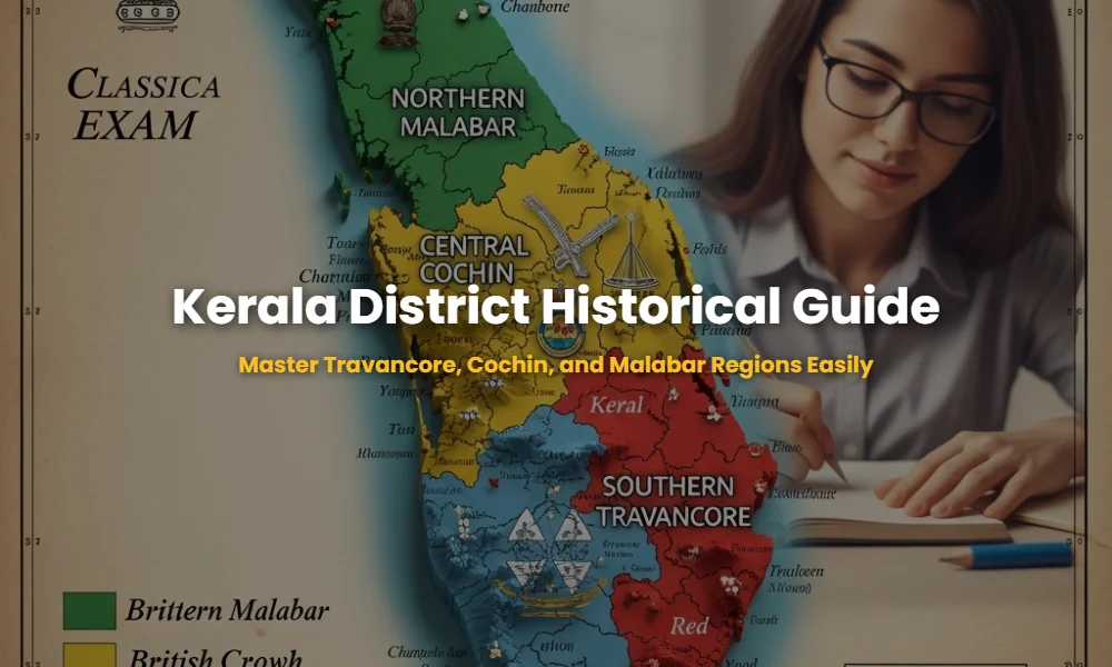
Understanding the administrative categorization of districts based on the historical regions of Travancore, Cochin, and Malabar is not just a history lesson; it is the backbone of Static GK for any Kerala PSC examination. Most candidates memorize district names in isolation, but the real advantage lies in understanding their lineage. Before the unification of Kerala in 1956, the land was divided into three distinct political entities, and questions regarding which district belonged to which region are common in KAS, VEO, LDC, and Degree Level Exams.
🚀 Key Takeaways
- Malabar: Comprised of the northern districts under direct British rule.
- Cochin: The central princely state that served as the commercial bridge.
- Travancore: The southern princely state known for its administrative reforms.
- Unified Kerala: Formed on November 1, 1956, merging these three unique administrative cultures.
- Critical Districts: Certain districts like Palakkad and Ernakulam have complex historical overlaps.
The Malabar Secrets Most Candidates Miss: The British Influence
The Malabar region historically consisted of the northern parts of Kerala which were under the direct administration of the British Madras Presidency. To win the Static GK section, you must understand that Malabar was not a princely state like the others, which is why its land tenure systems and administrative structures differed significantly.
The Malabar district was initially divided into North Malabar and South Malabar. Today, the administrative descendants of this region include Kasaragod, Kannur, Wayanad, Kozhikode, Malappuram, and Palakkad. However, aspirants should note that parts of modern-day Palakkad and Malappuram were influenced by the Mysore invasion, a favorite topic for PSC question setters. For more deep-dives into district formation, check out our comprehensive district formation timeline.
- Kasaragod: Formed from Kannur in 1984, but historically the northernmost tip of the British Malabar.
- Kannur: Known as the ‘Crown of Malabar’, it was the headquarters of the North Malabar region.
- Kozhikode: The administrative capital of the entire Malabar District during British rule.
- Wayanad: Carved out from Kozhikode and Kannur, representing the high-range Malabar.
- Malappuram: Formed in 1969, merging the taluks of Ernad, Perinthalmanna, Tirur, and Ponnani from Malabar.
💡 Click to Reveal: The Malabar Question Trap
Question: Which modern-day district was the capital of British Malabar? Answer: Kozhikode (Calicut). Pro-Tip: Don’t confuse it with Kochi, which was a separate princely state!
The Cochin Core: The Sneaky Central Districts You Cannot Afford to Ignore
The Kingdom of Cochin was the smallest of the three regions but held the most strategic maritime position. For Static GK purposes, Cochin is primarily represented by modern-day Thrissur and parts of Ernakulam. If you ignore the nuances of the ‘Cochin State’, you will fail questions regarding the ‘Paliyam Satyagraha’ or the development of the Cochin Port.
Unlike Malabar, Cochin was a princely state that maintained a subsidiary alliance with the British. This meant it had its own Diwan and administrative system. When the Travancore-Cochin state was formed in 1949, these districts were the first to integrate. Learn more about the Diwans of Cochin to boost your rank.
- Thrissur: The Cultural Capital was the heart of the Cochin State.
- Ernakulam: While Ernakulam city was the capital of Cochin, the district today includes parts that were formerly in Travancore (like Muvattupuzha and Kothamangalam).
💡 Click to Reveal: The Cochin Boundary Fact
PSC often asks: Which princely state was known as the ‘State of the Perumpadappu Swaroopam’? Answer: Cochin. Keep this in your Static GK notes!
The Travancore Legacy: Are You Losing Marks in the South?
Travancore was the largest and most influential princely state in southern Kerala. In the Static GK categorization, Travancore encompasses Thiruvananthapuram, Kollam, Pathanamthitta, Alappuzha, Kottayam, and Idukki. This region was a pioneer in education and social reforms, lead by rulers like Sree Chithira Thirunal Balarama Varma.
The administrative reach of Travancore extended from Kanyakumari (now in Tamil Nadu) to the borders of Cochin. When studying for Kerala PSC, ensure you link the historical ‘Proclamation of 1812’ or the ‘Temple Entry Proclamation’ to these specific districts. For a deeper understanding, explore the History of Travancore Social Reforms.
- Thiruvananthapuram: The permanent capital of the Travancore Kingdom.
- Kollam: Once the commercial hub of Travancore and an ancient trading port.
- Alappuzha: The ‘Venice of the East’, developed as a major port by Raja Kesavadas (Diwan of Travancore).
- Kottayam: The first town in India to achieve 100% literacy, a legacy of Travancore’s focus on education.
- Pathanamthitta: Formed in 1982, predominantly from the lands of Travancore.
- Idukki: While largely hilly, its administrative roots lie deep within the Travancore forest lands.
The Ultimate Comparison Table: Regional Categorization At A Glance
Use this table for your final 10-minute revision before the exam. It summarizes the administrative lineage of Kerala’s districts perfectly for Static GK.
| Feature | Malabar | Cochin | Travancore |
|---|---|---|---|
| Political Status | Direct British Rule | Princely State | Princely State |
| Districts Covered | Kasaragod, Kannur, Wayanad, Kozhikode, Malappuram, Palakkad | Thrissur, Parts of Ernakulam | TVM, Kollam, Alappuzha, Pathanamthitta, Kottayam, Idukki |
| Key Admin Center | Kozhikode | Ernakulam | Thiruvananthapuram |
| Merged In | 1956 (Kerala State) | 1949 (Travancore-Cochin) | 1949 (Travancore-Cochin) |
Don’t Get Fooled: Complex District Boundaries
One of the most complex parts of Static GK is the crossover of districts. For instance, Ernakulam district was formed by taking portions from both Cochin and Travancore. Similarly, Palakkad contains regions that were part of the Malabar district but have cultural ties to central Kerala. Understanding these nuances is what separates a topper from a regular aspirant.
💡 Click to Reveal: The 1956 Secret
When Kerala was formed on Nov 1, 1956, how many districts were there initially? Answer: 5 Districts (Malabar, Thrissur, Kottayam, Kollam, Thiruvananthapuram). This is a high-frequency PSC question!
Need Personalized Coaching for Kerala PSC?
Join our exclusive mentorship program and get access to detailed Static GK notes, mock tests, and 24/7 doubt-clearing sessions with expert examiners.
💬 Chat with our Experts on WhatsApp (+91 9526806124)