Translate Language
SRO-NASA’s NISAR Satellite Launch: Key Features
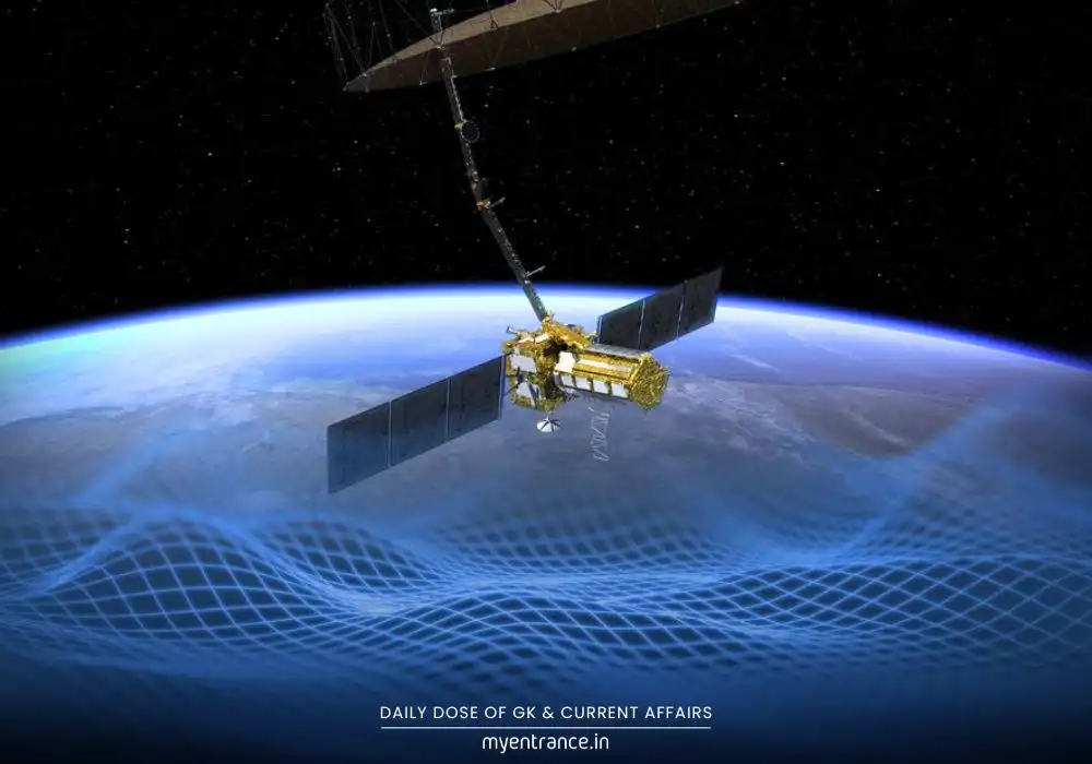
The NISAR satellite, a joint mission by ISRO and NASA, is set to redefine Earth observation with its cutting-edge radar technology. Scheduled for launch today, it will provide unprecedented data on climate change, natural disasters, and resource management. Here’s why this mission is a giant leap for science and global cooperation.
NISAR: A Breakthrough in Earth Monitoring
The NASA-ISRO Synthetic Aperture Radar (NISAR) is designed to capture ultra-precise images of Earth’s surface, detecting changes as small as 1 centimeter. Unlike traditional satellites, NISAR operates 24/7, even through clouds and darkness, making it invaluable for real-time monitoring.
Key Features of NISAR Satellite:
Dual-Band Radar Technology: Combines NASA’s L-band radar (24 cm wavelength) and ISRO’s S-band radar (9 cm wavelength) for unmatched precision.
Global Coverage: Scans the entire planet every 12 days, ensuring consistent updates on environmental changes.
Sun-Synchronous Orbit: Positioned at 747 km altitude for optimal lighting conditions in imaging.
3-Year Mission Life: Will generate continuous data for climate studies, disaster response, and sustainable development.
Why NISAR Stands Out
NISAR isn’t just another satellite—it’s a technological marvel and a symbol of global collaboration.
First Hardware Collaboration: NASA and ISRO have jointly developed the radar systems, marking a historic partnership.
Heavy Payload Launch: ISRO is using the GSLV-F16 rocket (instead of PSLV) due to NISAR’s massive size.
Free Public Data: Unlike most missions, all NISAR data will be openly accessible, boosting global research.
Uses of the NISAR Satellite
NISAR’s high-resolution imaging will have far-reaching applications:
✅ Climate Change Studies:
Tracks melting glaciers, deforestation, and sea-level rise.
Monitors carbon storage in forests and wetlands.
✅ Disaster Management:
Predicts earthquakes, landslides, and volcanic activity.
Provides real-time flood and cyclone monitoring.
✅ Agriculture & Water Resources:
Assesses soil moisture and crop health.
Tracks groundwater depletion.
✅ Urban & Infrastructure Planning:
Detects land subsidence and structural changes.
Helps in sustainable city development.
✅ National Security & Transparency:
Enhances border and maritime surveillance.
Promotes open data sharing for global scientific progress.
Key Q&A About NISAR
Q1: What makes NISAR different from other Earth observation satellites?
A: NISAR uses dual-frequency radar, allowing it to capture minute surface changes (even 1 cm shifts) in all weather conditions, unlike optical satellites that rely on sunlight.
Q2: How often will NISAR scan the Earth?
A: It will provide full global coverage every 12 days, ensuring frequent updates for accurate monitoring.
Q3: Why is NASA collaborating with ISRO on this mission?
A: NASA brings expertise in L-band radar, while ISRO contributes the S-band radar and launch capabilities, making it a cost-effective, high-impact partnership.
Q4: How will NISAR help in disaster management?
A: It can detect pre-earthquake land shifts, monitor flood-prone areas, and track cyclone movements, enabling faster emergency responses.
Q5: Will NISAR data be available to the public?
A: Yes! All scientific data from NISAR will be freely accessible, aiding researchers, governments, and environmentalists worldwide.
The NISAR mission is a giant leap for Earth science, combining cutting-edge technology with global cooperation. From tracking climate change to saving lives during disasters, its impact will be felt worldwide. Stay tuned for more updates on this revolutionary satellite!
For more exam tips and latest science/tech news, visit MyEntrance.in.
Get 3 Months Free Access for SSC, PSC, NIFT & NID
Boost your exam prep!
Use offer code WELCOME28 to get 3 months free subscription. Start preparing today!
Read More Topics